Editor’s choice
Editor’s choice
A new update to the Fossil Fuel Atlas exposes the growing exploitation of the Amazon rain forest, serving as an early warning system for communities whose lands may be targeted for oil and gas drilling. What it shows is that nearly 20% of the Amazon region is designated for leasing for fossil fuel exploration and extraction.
This upgrade empowers communities with information to help safeguard their water, land and health in formal impact assessment processes.
The Fossil Fuel Atlas, already a vital resource and tool for users supporting a transition to sustainable energy sources, received a critical update in December: a map of the Amazon that lays bare the expanding footprint of oil and gas extraction in the region.
The Fossil Fuel Atlas shows where oil lease blocks overlap with or border protected lands.
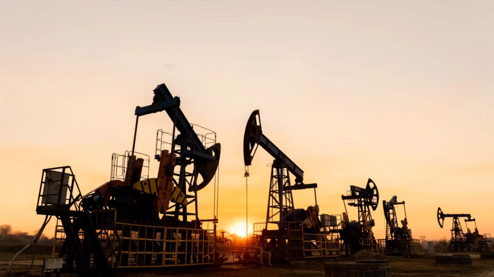
Image: Fossil Fuel Atlas / SEI
The Fossil Fuel Atlas, developed by Global Energy Monitor, Institute for Governance and Sustainable Development, and SEI, is an interactive mapping platform that visualizes fossil fuel projects and their potential health and environmental risks.
Designed for non-experts as well as specialists, the Atlas allows users to easily explore maps, visualize impacts, and create shareable geostories without technical training. While developed by research institutions, its primary audience extends well beyond academia to include community organizations, journalists, international NGOs, financial institutions, and policymakers.
The Fossil Fuel Atlas has three distinct goals: expand access to reliably sourced information regarding fossil fuel use and its impacts, empower civil society to assess threats and advance alternatives, and support global movements to counter climate change and accelerate the just transition to clean energy.
“A pervasive issue in community development is that while most nations have a legal framework for environmental and social impact assessments, residents are often notified of impending projects with little advance notice,” says Sivan Kartha, Senior Scientist at SEI US and a co-founder of the Atlas. “This limited time frame significantly curtails their ability to review the proposed projects, meaningfully engage in formal impact assessment processes, or negotiate with the developers,”
“There’s a lot of ongoing expansion of oil and gas extraction … but local communities are often informed of a proposed project only once substantial development has already taken place,” Kartha says. “So this data that we’re providing serves as a kind of early warning system that says, ‘Hey, your land is being opened up for oil and gas exploration and extraction.’”
One region where this is particularly prevalent is the Amazon, the world’s largest rainforest and one of the world’s most important carbon sinks. Fossil fuel development in this region can potentially harm essential biodiversity and keystone species, disrupt water resources, and undermine the livelihoods and cultural heritage of Indigenous groups and Amazonian communities.
“Community members and local organizations invariably need more time and more information to really grasp what is being planned and its implications so they can fully engage in the available public consultation processes,” Kartha says.
An oil extraction site stands along the Napo River in Ecuador’s Amazon rainforest, marked by a gas-flaring chimney and storage tanks. Oil drilling in the region has driven deforestation, fragmented critical habitats, and caused pollution that threatens both biodiversity and Indigenous groups.
This map displays areas identified for future oil and gas exploration and development, drawing from official government information sources relating to land areas that have been or are slated to become available for oil and gas exploration and drilling concessions. The tool’s legend categorizes lease blocks as pre-lease, pre-production, production, and post-production, depending on where the land parcel is in the extraction cycle, enabling communities to identify projects’ progress and advocate for their interests accordingly.
Having assembled this dataset from a range of government sources, what stands out is that nearly 20% of the Amazon region is designated for leasing for exploration and extraction. Moreover, major portions of the 470 existing oil and gas lease blocks in the Amazon, overlap significantly with critical water systems, including almost 90% of aquifers. This overlap increases the substantial risk of water contamination and long-term environmental damage from fossil fuel exploitation.
The map further illustrates instances where lease blocks intrude upon Indigenous territories and protected conservation zones, thereby threatening both sovereignty and conservation efforts. Preserving these areas is vital for maintaining forest ecosystems and stabilizing the climate, yet development projects persist with little governmental opposition.
In Alalapadu, Suriname, a small group of Indigenous women and children walk through their village in the Amazon rainforest, heading toward traditional wooden homes. As much of the land designated for oil production remains in its early stages of development, communities can use information from the Fossil Fuel Atlas to voice concerns about the risks of oil spills, rising sea levels, and increasingly severe weather events.
This new resource offers a crucial advantage: Its analysis underscores how future policy decisions can still significantly influence development in key areas.
“The purpose of this tool is to provide the data in a way that’s really easily accessible and can be adapted and so anyone can really use the data we have assembled and create their own map-based ‘geostories’,” Kartha says. “It’s meant to be something that requires very little effort and no GIS [geographic information system] expertise.”
By using the accompanying interactive map, communities and civil society organizations gain an early warning system. This empowers them to assist communities in better understanding how these developments might affect their wellbeing and local environment, as well as more effectively advocating for their interests and for sustainable alternatives.
Tool / This web-based platform tracks fossil fuel infrastructure development and enables users to evaluate potential threats to ecosystems and communities.
Other publication / A GIS-based platform allows users to visualize current and planned fossil fuel infrastructure and its overlap with areas of ecological and cultural importance.
Press release / The Fossil Fuel Atlas is a new tool that allows the public to see where existing and emerging fossil fuel extraction projects encroach on protected ecosystems.
SEI working paper / This working paper examines cases in Colombia and México where gas infrastructure is expanded with little market justification, risking gas lock-in.