Editor’s choice
Editor’s choice
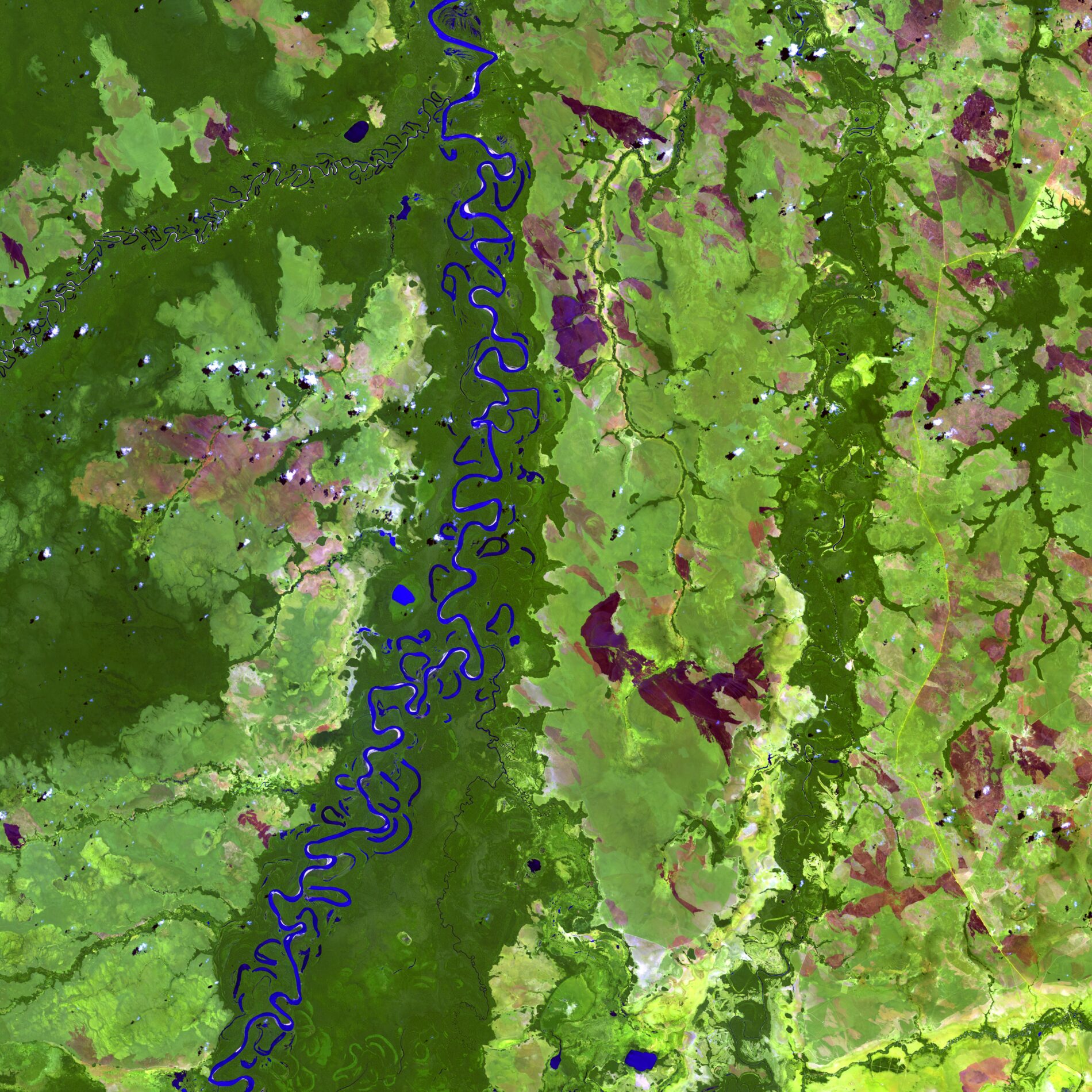
The sparse and uneven distribution of meteorological stations creates a challenge in generating continuous spatial coverage of precipitation data for water planning and study. So when the Ministry of Environment and Water of Bolivia (MMAyA) commissioned a national-level water basin study led by SEI, they turned to the Gridded Meteorological Ensemble Tool (GMET).
Photo: US Geological Survey / Unsplash.
SEI brief / SEI researchers used the Gridded Meteorological Ensemble Tool for a water balance study in Bolivia, marking the first time the tool was applied outside the US.
Project / Bolivia WATCH preparará a las instituciones del país con la información y la capacidad para conectar saneamiento seguro y gestión de cuencas hidrográficas.
Tool / The Water Evaluation and Adaptation Planning tool (WEAP) provides a comprehensive and user-friendly framework for policy analysis in water resources planning.
Feature / Bolivia faces a deepening water crisis. SEI helped plan for the future by creating the first-ever comprehensive model of Bolivia’s rivers, lakes and streams.
Feature / SEI researchers recently unveiled the first comprehensive model of Bolivia’s rivers, lakes and streams, as part of the Bolivia National Water Balance.
Project / This project will assess the impact of climate change on the Katari watershed and evaluate potential conflicts between ecohydrological and urban water demands.
Journal article / This study is one of the first to assess the relationship between women's empowerment and participation in community-managed water and sanitation.
Past event / SEI researchers will present their project and initial findings on the potential for satellite data to support the use of traditional ecological knowledge.