Editor’s choice
Editor’s choice
Changing rainfall patterns, increasing water use and declining flows are leading to the disappearance of a vital lifeline for Nepal’s Midhills communities. The Midhills springs need be recharged and better managed.
Photo: “Paddy fields of Nepal” by Sharada Prasad CS, CC BY 2.0
South of the high Himalaya mountains lies a strip of land known as the Midhills, where communities farm on terraces perched above deep ravines. People in these communities depend on springs – often the only accessible sources of water.
The springs tap water that has filtered into aquifers during the monsoon months. In the dry season, the aquifers serve as a buffer: storing a year-round water supply for drinking, irrigation, and livestock.
But the springs are disappearing. Over the last decade, studies identified changing rainfall patterns, increasing water use, and declining spring flows. In many locations, the springs have already dried up and climate change is likely to exacerbate these trends, putting livelihoods at greater risk.
Unlike rivers, understanding, managing and conserving the springs has lower precedence because of their sporadic distribution in remote locations and limited significance beyond the communities that depend on them.
Recent projects such as Building Climate Resilience of Watersheds in Mountain Eco-Regions (BCRWME), Himalayan Adaptation, water and Resilience (HI-AWARE) and the Himalayan University Consortium (HUC) are working on multiple fronts to bridge these gaps and revive the springs.
Key knowledge gaps in understanding the Midhills springs are the biggest impediment to designing conservation and management plans for sustainable use. The following gaps need to be addressed in the research, following the projects mentioned above.
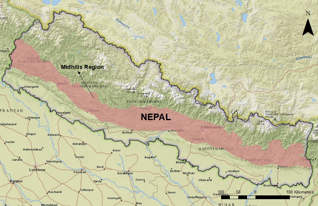
Location of Nepal’s Midhills. Image: Karthikeyan Matheswaran / SEI.
There is an urgent need to develop a comprehensive map of springs used by Midhill communities. This will reveal the scale of the issue, identify dependent villages, and provide a valuable resource for community-led management. BCRWME, HI-AWARE and HUC are currently collating spring location data.
Information on localized rainfall patterns is often used for preliminary understanding of spring systems, and the Midhills have 40 climatological observatories maintained by the Department of Hydrology and Meteorology that can gather such data.
Yet a recent study from two catchments located 21 kilometres apart showed that this existing network is not enough. Rainfall is highly variable in mountain regions, and localized measurements must be studied before interventions for spring revival are designed.
Unfortunately, it is not financially viable to increase the number of high-end rain gauges with the sole aim of reviving springs. There are too many springs in the Midhills: around five to seven per square kilometer, based on rough estimates.
An alternative solution would be to combine technological advancements in open-source sensors with citizen science approaches to collect information relevant for each region. Data generated using such co-produced knowledge systems must be available to all, without barriers.
Subsurface geological stratum are underground storage tanks, and springs are their outlets. Knowledge of local hydrogeology is essential for understanding the dynamics of these systems at the local scale – vital for managing the spring systems.
Existing hydrogeological maps provide an overview of rock types prevalent in the study area, but local-scale data is scarce on details such as subsurface aquifer types, depth of the top aquifer, dip direction of rock beddings, and fractures and fissures. Expert analysis is needed to identify relevant hydrogeological features.
Recharge zones are formations where water filters into the underlying strata and accumulates as groundwater. After accumulating, the water emerges on the lower parts of slopes or in narrow valleys as springs.
Protecting these recharge zones forms the crux of conservation interventions. Watershed-focused conservation programmes rarely account for groundwater, as it often moves beyond surface watershed boundaries.
So a “springshed” approach has been developed – encompassing the land where rainfall infiltrates the ground and reemerges as springs (often covering more than one watershed). This approach will guide siting of recharge ponds and rainwater harvesting, and has been successfully piloted in the Indian state of Sikkim through their Dhara Vikas Programme.
Springshed pilots in Nepal include:

Close-up view of the Midhills. Photo: Sanita Dhaubanjar / IWMI.
Two recharge zone identification methods were used in Nepal: the hydrogeological method and the isotope method.
Researchers recently used natural isotopes to identify spring recharge zones in two small mountainous catchments in the far-western Midhills. Isotope measurements provide accurate demarcation of recharge areas, but, when used alone, do not provide a holistic understanding.
Cost is a prohibitive factor for upscaling the isotope approach to many locations, and there is a risk that the sampling locations may not cover the actual recharge area.
Developing capacity in Nepal to undertake analyses of isotopic composition in different water sources is an important next step, and this will lead to cheaper ways of identifying and managing spring systems.
Information on neglected traditional recharge ponds, along with tapping into knowledge on traditional community water conservation measures, will provide a faster way to design and implement spring conservation measures in the Midhills.
An approach that combines traditional conservation measures with hydrological spring monitoring will enhance community appeal while providing a cost-effective scientific way to implement and test the efficacy of the planned interventions. Socio-economic reasons for the neglect of traditional ponds must be investigated before intervention takes place.
The power dynamics of local groups with access to the spring water needs to be documented, as does current societal water usage and traditional water sharing mechanisms.
Calculating the socio-economic costs of sustaining springs is vital for addressing flow reductions, and can be used to communicate awareness on the consequences of these reductions to local communities and policy-makers.
The springs of Nepal’s Midhills are a vital lifeline to area communities. They serve as a year-round supply of water for drinking, irrigation and livestock, particularly during the dry season. They are, however, disappearing. In many locations, they have already dried up, and climate change likely will intensify these negative trends. The Midhills springs not only need to be recharged, but also better managed.
Spring origin, flows and yearly states must be better understood. Steps that can be taken to fill in these knowledge gaps include developing a comprehensive map of springs, improving site-specific rainfall data, undertaking an expert analysis to identify relevant hydrogeological features, better protecting recharge zones, tapping traditional knowledge and documenting the power dynamics of local groups with water access. Though some of this work, such as mapping and “springshed” pilot projects, has already started, more local and water-specific expertise clearly will help achieve greater spring preservation.
Thanks to Ms Sanita Dhaubanjar, IWMI and Mr Madhav Dhakal, ICIMOD for their suggestions and comments on this piece.
Perspective / SWARM, a new platform for water management, combines hydrological modelling and stakeholder input to improve river basin management in Southeast Asia.
SEI report / Sediment carriage and deposition in the Mekong River have been altered in part by infrastructure development, riverbed mining and climate change.


