Editor’s choice
Editor’s choice
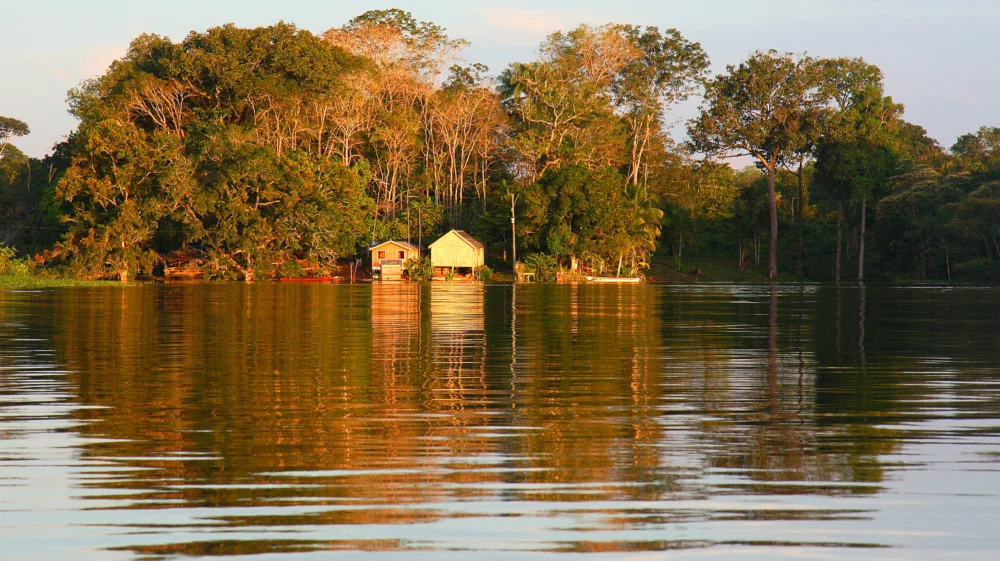
WWF together with Chalmers University of Technology, Trase and SEI launched a new report during COP16, providing the first detailed analysis of agricultural commodities contributing to deforestation at the subnational level across the Amazon region.
Pasture expansion is a major deforestation driver in the east and central Amazon, while crop expansion – including soy in Bolivia and staples like maize, rice, and cassava in other areas – plays a significant role in the western and southern regions.
At an event during COP16 in Cali, Colombia, WWF, in collaboration with Chalmers University of Technology, Trase and SEI launched the report “Uncovering Sub-Regional Drivers of Deforestation in the Amazon: A Tool for Targeted Solutions”. This pioneering analysis unveils how specific agricultural commodities, from cattle ranching to crops, are driving forest loss at subnational levels throughout the Amazon region.
By using the DeDuCE model, which combines the best available spatial and statistical data, this report provides the first-ever detailed picture of the agricultural commodities causing deforestation at the subnational level across the Amazon region.
The Amazon has already lost between 14 to 17% of its forests, and according to the Science Panel for the Amazon, the region could reach an ecological tipping point once it reaches 20 to 25% of forest loss. Most of this deforestation is due to the production of commodities that are consumed domestically, traded regionally or exported outside the Amazon. Although data have been available for Brazil before, the report is the first to offer data on the link between specific commodities at the level of subnational jurisdictions across all Amazonian countries.
Dr. Chandrakant Singh, one of the authors of the report, explained:
Our new analysis reveals the specific agricultural commodities that drive deforestation across the Amazon. It highlights the fact that pasture expansion is driving more deforestation in eastern and central regions, cropland expansion being more important in the west and south, and that the impact of land speculation is of comparable magnitude to deforestation driven directly by the expansion of productive agricultural land."
Dr. Chandrakant Singh, author of the report
The report identifies deforestation driven by agriculture and cattle ranching is declining in most Amazon countries in recent years (2017-2022), except for Brazil – where it is relatively stable – and Ecuador – where it is much higher than historical levels. Despite cropland expansion accounting for only 22% of direct total deforestation between 2017-2022, compared to 78% from cattle ranching, trends indicate that it is becoming a more prevalent driver of deforestation across the Amazon region, particularly in Bolivia, Ecuador, Peru and Venezuela.
At the same time, sub-national deforestation patterns across the Amazon reveal distinct drivers (2017-2021), with pasture dominating in the eastern and central portions of the Amazon – but advancing into the interior of the region, and crop expansion – particularly soy in Bolivia and staples like maize, rice, and cassava in Peru and Venezuela – prevailing in the western, southern, and northwestern subregions.
The report also reveals “contrasting patterns in deforestation dynamics at the sub-national level that are not evident from the national-level deforestation estimates” argued author Dr. Vivian Ribeiro, “highlighting the need for targeted strategies and interventions to address deforestation, tailored to specific sub-national contexts”.
Dr. Vivian Riberio, Data Scientist for Trase at SEI
To support decision-making, the report provides an online open-access dashboard, where users can find commodity-level deforestation estimates for each country and sub-national region where data exists across the Amazon, available at www.deforestationfootprint.earth/amazon.
Kurt Holle, director of WWF Perú and of WWF’s Amazon Coordination Unit explained that “having detailed subnational data on Amazon-wide deforestation can enable targeted interventions to enhance supply chain transparency and drive cross-sectoral solutions towards the goal of halting deforestation by 2030 to avoid the tipping point.”
The findings also reveal that not all tree cover loss in the Amazon is deforestation. The tree cover loss that is not classified as deforestation constitutes degradation caused by fires, among other phenomena. Forest degradation comes out as a risk to the Amazon comparable to that of deforestation driven directly by the production of commodities.
Other publication / This technical brief presents the first subnational, commodity-specific analysis of agricultural drivers of deforestation across the Amazon region.
The report was launched at the 2024 UN Biodiversity Conference (CBD COP 16) in Cali, Colombia. It was discussed by a panel of experts, including representatives from the Amazon Cooperation Treaty Organization, the Science Panel for the Amazon, and the Inter American Development Bank. This initiative is part of a larger project which aims to develop, by Climate Change COP 30 (Brazil, 2025) information on the domestic, regional, and international supply chains driving this commodity-led deforestation in the Amazon, as well as the financial actors and sectors involved.
Trase is a data-driven transparency initiative that maps the international trade and financing of agricultural commodities, providing tools that enable companies, financial institutions and governments to address tropical deforestation. This not-for-profit partnership was founded in 2015 by the Stockholm Environment Institute and Global Canopy.
Perspective / Trase’s co-directors write about the benefits and limitations of Trase data in assisting companies and governments in their efforts to implement the EUDR.
Feature / Forest IQ, developed by SEI, Global Canopy and ZSL, has been named “one to watch” by the Global Good Awards.
Feature / A new Trase data set brings unprecedented transparency to the supply chains and impacts of Brazilian cattle and beef production.